 |
| Coffeepot Lake Washington |
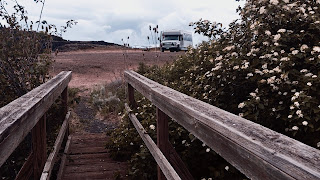
Free Camping is available with a limited amount of campsites.
Basalt cliffs frame this eastern Washington lake, with more than 900 acres bordering the lake managed by Bureau of Land Management (BLM) for its wildlife habitat, as well as recreational opportunities.
A picnic and camping area is conveniently located near the fishing dock and boat launch along with a nice vaulted toilet. You can enjoy a simple picnic or stay overnight after a day on the lake or a nice hike. Enjoy the wildflowers, wildlife and a little bird watching. You might spot a vulture or prairie falcon along the cliffs, or the more common Canada geese, red-tailed hawk, and kestrel near the lake. We even caught a glimpse of Osprey and an American White Pelican.
Getting There:
Longitude/Latitude 47.4908° N, 118.5683° W
Located west of Harrington, in Lincoln County, Washington. From Highway 28, turn west onto Coffeepot Road and travel about 12 miles to the gravel entrance on the left. Plan for a drive of one to two hours from Spokane. Watch our video Free Camping at Coffeepot Lake
 |
| Twin Lakes Washington |
The south end of Upper Twin Lake offers picnicking and camping with a few primitive campsites. Popular activities here are fishing and paddling on the lakes, hiking, backpacking, hunting, horseback riding, bird watching and wildflower viewing and photography. Anglers fish for stocked rainbow trout, large mouth bass, yellow perch, yellow bullhead, black crappie, and sunfish. Trails wind through the area and wetlands supporting numerous bird populations north of the lakes invite overland hikers to come and explore.
The Twin Lakes Area is open year round. Both lakes have primitive boat launches, and the upper lake also has a small dock and there is a vault toilet available.
For fishing or hunting regulations be sure to check with the Washington State Department of Fish and Wildlife.
Getting there:
LATITUDE / LONGITUDE 47.53033° N , 118.50583° W
From Highway 28 at Harrington turn west onto Coffeepot Road and travel about 12 miles, then turn right onto Highline Road. Watch for public land access signs. Drive 1.5 miles to the entrance on the right. Follow this access road for about two miles to reach the recreation site.
Watch our video: Free Camping Twin Lakes Washington
 |
| Escure Ranch, Endicott WA |
Endicott, Washington
LATITUDE / LONGITUDE 47.014299° N, -117.943748° W Elevation: 1457'
The road in is Gravel and 10 miles from a paved road.
Directions from the north:
From I-90, take the exit for SR 23 and go south 8 miles, through the town of Sprague, and turn right on Lamont Road. In about 2.5 miles Lamont Road bends left and turns into Revere Road; 8 miles after the turn, go right on Jordan-Knott Road, then another 2 miles until you reach Rock Creek Management Area, another right turn. Drive until you reach a parking area with vaulted toilets.
Watch our video: Free Camping Escure Ranch
No comments:
Post a Comment